Deep Sea Mud Maps 500-Year Earthquake Pattern Off California
Scientists using underwater robots have cracked the code on reading ancient earthquake records hidden in deep ocean mud. Their breakthrough could help predict when the next massive quake will strike the Pacific Northwest.
Scientists just figured out how to read the ocean floor like a history book, and it's revealing when the next big earthquake might shake the Pacific Coast.
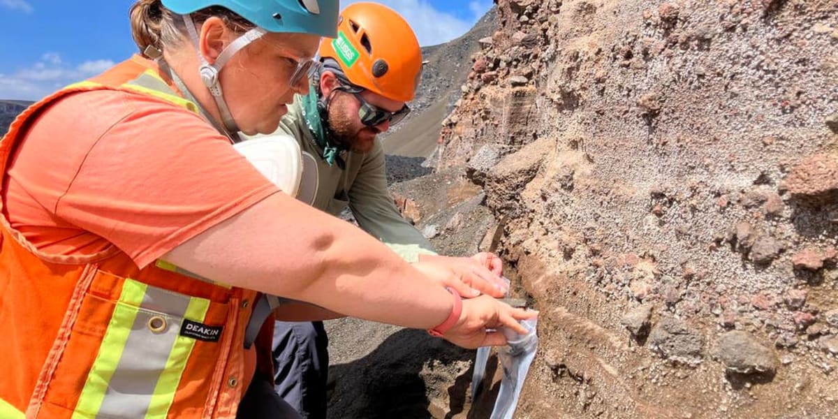
Researchers from the U.S. Geological Survey sent underwater drones to map the seafloor off Crescent City, California, creating the clearest pictures scientists have ever had of this hidden world. What they found could save lives.
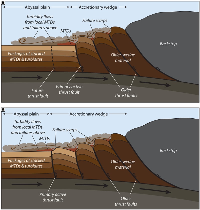
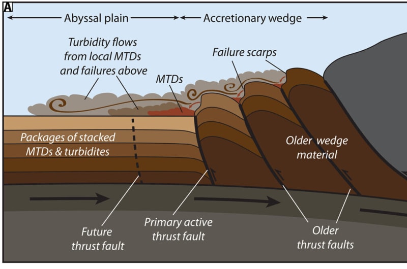
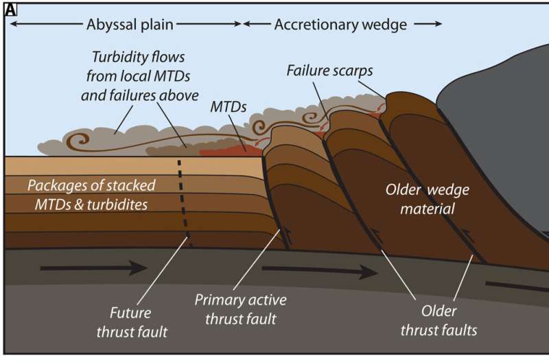
For years, geologists have studied layers of mud on the ocean floor to understand earthquake history. But there was a problem: they couldn't tell if these mud slides were triggered by earthquakes or just bad storms. That uncertainty made the records nearly useless.
Enter research geologist Jenna Hill and her team. They didn't just look at the mud layers. They compared the age of mud from steep underwater hills with the mud that had slid to the ocean floor below.
What they discovered changed everything. The mud on top of the hills was the same age as the mud on the bottom. Normally, landslides leave older material underneath, but these hills are constantly "refilling" from below.
The reason? The study area sits on a subduction zone where two massive tectonic plates grind together. This grinding squeezes fresh mud up from deep underground to the tops of steep hills. Because these hills are so far beneath the ocean surface, storms can't affect them at all.
That means when the mud slides, it's definitely from an earthquake, not weather. Finally, scientists have a reliable earthquake clock.
Why This Inspires
Using this method, the team mapped out a precise timeline of giant earthquakes along 600 miles of coastline from Northern California to Canada. They confirmed these megaquakes strike every 500 years on average. The last one hit in 1700.
The math is sobering but the breakthrough is empowering. For the first time, communities in the Pacific Northwest have a clear window for when to expect the next big one. That knowledge means better building codes, smarter emergency plans, and more lives saved when it happens.
This research proves that sometimes the answers we need are right beneath our feet, or in this case, miles beneath the waves. Scientists are now using this same technique along subduction zones worldwide, turning uncertain guesses into reliable predictions.
The ocean floor just became humanity's best early warning system.
More Images

Based on reporting by Phys.org - Earth
This story was written by BrightWire based on verified news reports.
Spread the positivity!
Share this good news with someone who needs it