NASA Mirror Tech Makes Your GPS More Accurate
A simple array of cube-shaped mirrors just made GPS navigation more reliable for everyone. The technology launched in January and started working this month on a new satellite orbiting Earth.
Your phone's GPS just got a quiet upgrade thanks to mirrors in space.
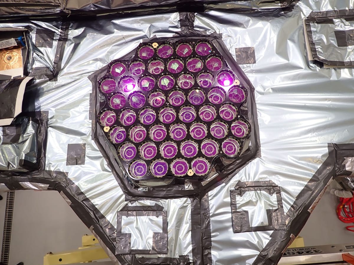
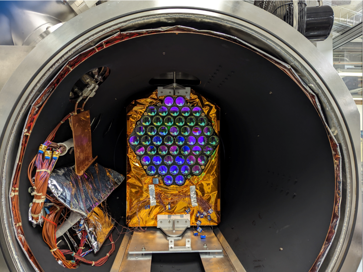
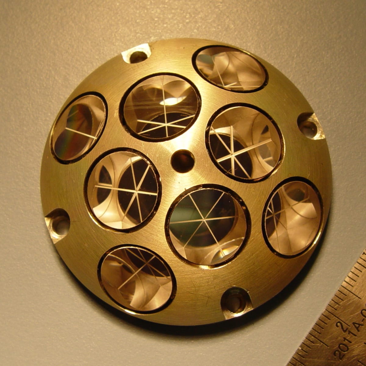
NASA activated a laser reflecting instrument on March 9 aboard a GPS satellite that launched in January. The device, called a laser retroreflector array, uses mirrors shaped like cube corners to bounce light beams back to ground stations on Earth.
The technology works by measuring how long it takes light to travel from the ground to the satellite and back. That precise timing helps scientists determine the satellite's exact position, which means more accurate location data for everyone using GPS.
"LRAs are the most efficient and cost-effective way to improve products that come out of GPS," said Lucia Tsaoussi, who manages NASA's Space Geodesy program. The mirrors give the satellite a stronger connection to the global coordinate system, making your maps and navigation more reliable.
The instrument launched aboard GPS III SV-09, the ninth satellite in the U.S. Space Force's newest GPS fleet. A SpaceX Falcon 9 rocket carried it into orbit from Cape Canaveral on January 27.
Most people never think about what makes their phone's location services work. "We are the hidden infrastructure," said Stephen Merkowitz, who manages NASA's Space Geodesy Project at Goddard Space Flight Center. "Most people don't realize that they're relying on these kinds of measurements every day throughout their lives."
The Ripple Effect
Better GPS accuracy helps far more than just finding the nearest coffee shop. Earth-observing satellites use GPS receivers to pinpoint their own locations in space, and when GPS gets more precise, all that satellite data becomes more reliable too.
Satellites tracking ice sheets, ocean levels, and Earth's gravity all depend on knowing exactly where they are. Missions like ICESat-2, SWOT, and GRACE-FO use similar laser-ranging technology to monitor climate and provide early warnings for natural hazards.
NASA operates a global network of laser ranging stations now tracking this latest GPS satellite. Local stations are already monitoring the mirrors, with international partners joining soon.
The technology came from a partnership between NASA's Space Geodesy Project and the Naval Research Laboratory's Naval Center for Space Technology. The mirrors will keep working for the satellite's entire operational life, continuously improving GPS accuracy for everyone on Earth.
More Images

Based on reporting by NASA
This story was written by BrightWire based on verified news reports.
Spread the positivity!
Share this good news with someone who needs it
%3Amax_bytes(150000)%3Astrip_icc()%3Afocal(999x0%3A1001x2)%2Fmars-rover-field-073126-1e9056218dc842cdb53565a4df6cf847.jpg)