New Laser Tech Maps Snow to Save Water in Parched West
Scientists are using cutting-edge laser technology from specialized aircraft to measure snowpack with pinpoint accuracy, helping water managers plan for millions of people across the drought-stricken American West. The innovation provides hope for smarter water management even as climate challenges grow.
High above California's Sierra Nevada mountains, a breakthrough technology is giving water managers a powerful new tool to tackle one of the West's biggest challenges.
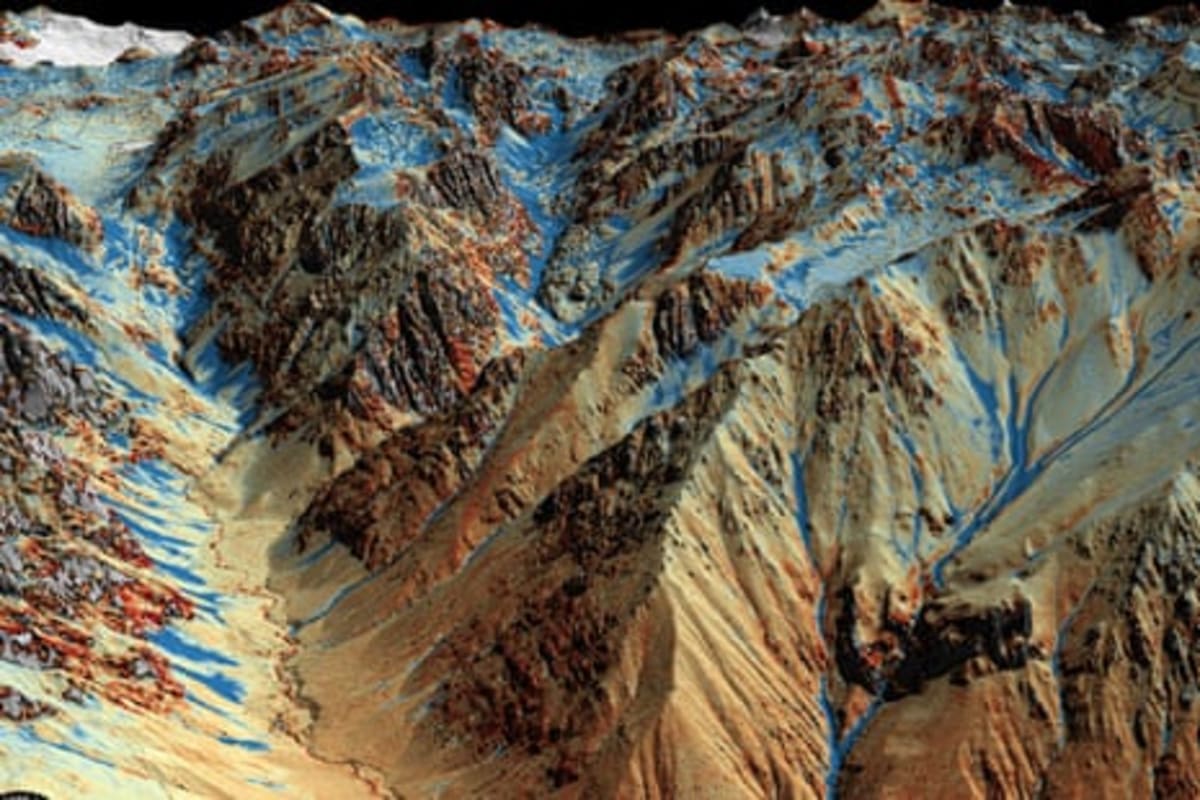
Tom Painter's specialized aircraft uses Lidar technology to map snow depth with stunning precision. The system fires 800,000 laser pulses per second, creating 3D maps accurate to within 3 centimeters and calculating exactly how much water is locked in mountain snowpack.
For the arid West, this data is gold. Mountain ranges act as natural frozen reservoirs, and knowing exactly how much water they hold helps officials plan water distribution for millions of homes and the farmland that feeds the nation.
Painter developed the technology at NASA before founding Airborne Snow Observatories. His flights now provide critical intelligence that old-fashioned ground measurements simply can't match.
The technology covers vast areas quickly and catches details that snow sensors buried at ground level miss entirely. Water managers can now forecast spring runoff months in advance with unprecedented accuracy.
Tom Albright, Nevada's deputy state climatologist, says the detailed maps help his team make smarter decisions about reservoir releases and water allocations. Having precise measurements means communities can prepare earlier and waste less of this precious resource.
The Bright Side
While this year's snowpack measurements show challenging conditions, the technology itself represents a major leap forward in water science. Better data means better planning, even in tough years.
The system is now deployed across multiple western states, creating the most comprehensive picture of mountain water storage ever assembled. This information helps everyone from farmers planning crops to firefighters preparing for dry seasons.
As climate patterns shift, tools like Painter's Lidar system become even more valuable. They transform guesswork into science and give communities the lead time they need to adapt.
The technology also helps scientists understand long-term trends, distinguishing between normal variation and deeper changes. That knowledge lets western states invest wisely in infrastructure and conservation programs.
Innovation like this proves that human ingenuity can rise to meet environmental challenges with smart solutions that make life better for everyone.
More Images


Based on reporting by Guardian Environment
This story was written by BrightWire based on verified news reports.
Spread the positivity!
Share this good news with someone who needs it