New NASA Satellite Sees Through Clouds to Study Earth
A groundbreaking satellite launched by NASA and India can peer through clouds to capture stunning images of Earth's surface, opening new possibilities for monitoring our changing planet. The mission features the largest radar antenna NASA has ever sent to space.
NASA's newest Earth-watching satellite just proved it can do something most space cameras can't: see straight through clouds to the ground below.
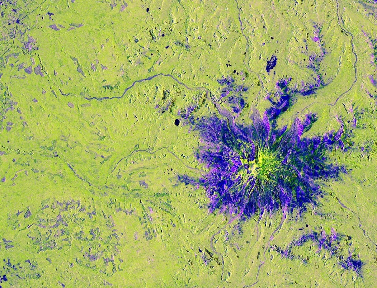
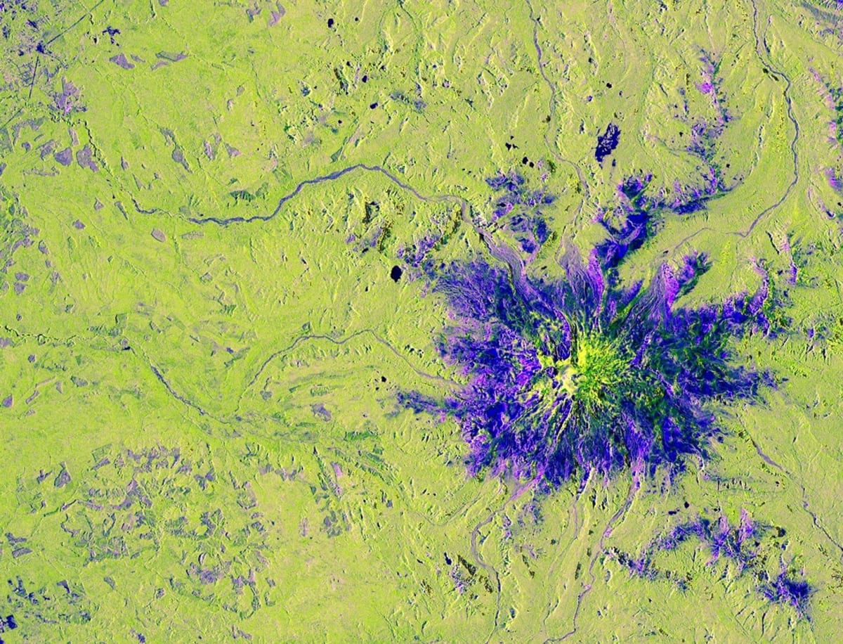
The NISAR satellite, a joint mission between NASA and India's space agency, captured a striking image of Washington's Mount Rainier on November 10, 2025. While clouds blanketed the Pacific Northwest that day, the satellite's advanced radar technology cut right through them to reveal the mountain and surrounding landscape in vivid detail.
The image looks like an otherworldly painting. Forests glow yellow-green across the region, while roads and buildings dot the landscape in magenta where radar signals bounce off their flat surfaces. At the mountain's peak, smooth vegetation-free areas appear dark blue, and near the base, purple patches show where forests have been thinned by human activity.
NISAR launched in July 2025 from India's southeastern coast, carrying technology that makes it unique among Earth observation satellites. It's the first spacecraft to use two different radar systems working together, and it sports a massive drum-shaped antenna reflector stretching 39 feet wide, the largest radar antenna NASA has ever launched into orbit.
The satellite circles our planet collecting data every 12 days, monitoring changes to land and ice surfaces worldwide. Unlike traditional cameras that need clear skies and daylight, NISAR's radar instruments work day or night, rain or shine.
Why This Inspires
This mission represents more than just impressive technology. It's a powerful example of international cooperation, with NASA providing the radar systems and antenna while India contributed the spacecraft and additional instruments. Scientists from both nations worked together to create something neither could have built alone.
The data NISAR collects will help researchers track melting ice sheets, shifting earthquake faults, and changing forests. That information could improve early warnings for natural disasters and help communities prepare for climate changes already underway.
For the Pacific Northwest region captured in this first image, the satellite's ability to monitor forests, water resources, and volcanic mountains like Rainier could provide valuable insights for years to come. The precise measurements of land changes will give scientists tools they've never had before.
Together, NASA and India have given the world a new way to watch over our shared home.
More Images
Based on reporting by NASA
This story was written by BrightWire based on verified news reports.
Spread the positivity!
Share this good news with someone who needs it