New Satellite System Tracks Ships Trying to Evade Sanctions
Ships trying to hide on the open ocean just got a lot easier to find. Japan's new satellite system uses AI to track vessels in real time, even when they turn off their location transponders.
Ships carrying illegal cargo have long used a simple trick to disappear: sail far from shore and switch off the transponder that broadcasts their location. That trick just stopped working.
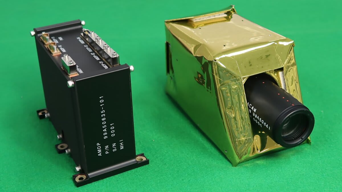
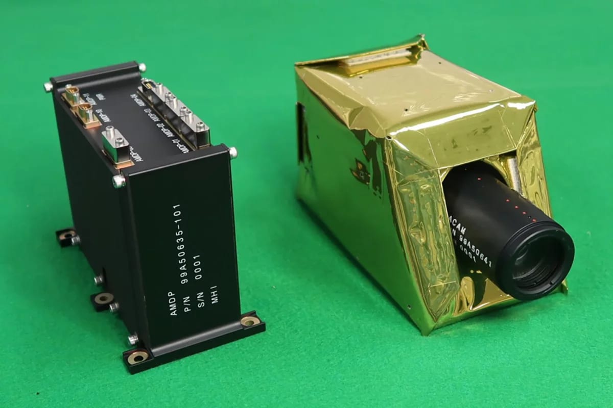
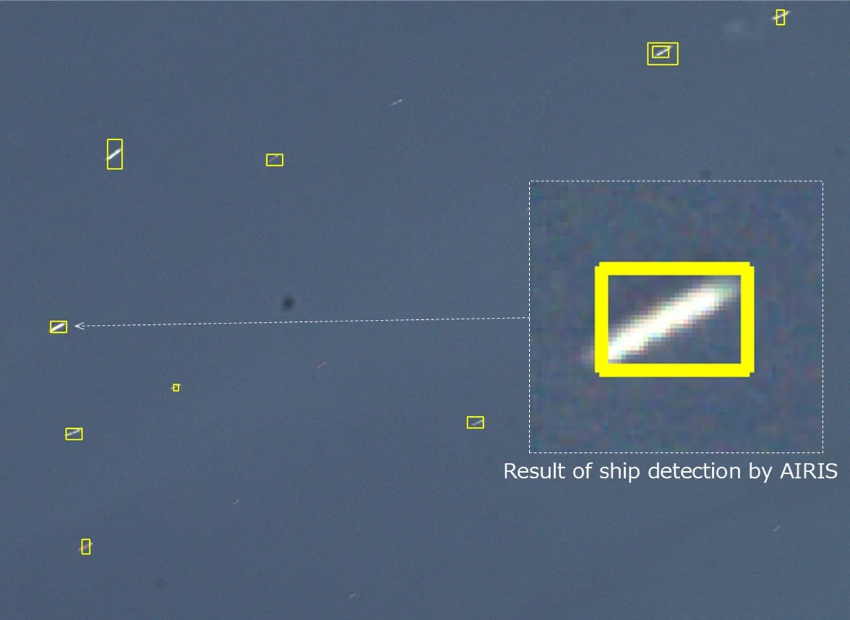
Mitsubishi Heavy Industries, working with Japan's space agency and the University of Tokyo, successfully tested a satellite system that can spot and track ships in real time using cameras and artificial intelligence. The technology, called AIRIS, solves a problem that has frustrated authorities for years.
The challenge has always been enormous. Oceans cover most of our planet, and finding one ship among millions of square miles of constantly shifting water requires processing massive amounts of satellite images. By the time analysts spot a vessel, it has usually moved somewhere else.
Countries like Russia, Iran, and North Korea have exploited this weakness to evade international sanctions. Their "ghost ships" carry oil and other goods despite trade restrictions, vanishing from tracking systems simply by flipping a switch. While most commercial vessels are legally required to broadcast their location, ghost ships ignore these rules, and until now, catching them meant getting lucky.
AIRIS changes the equation by doing the hard work in space instead of on Earth. The satellite's onboard processor analyzes images as they're captured, identifying ships against the chaotic ocean surface and sending only the relevant data back to ground stations. What used to take hours now happens in near real time.
The system can even teach itself to get better at spotting ships as conditions change. Different weather, lighting, and sea states all affect how vessels appear from space, but AIRIS adapts on the fly, refining its search patterns to match what it's actually seeing.
The Ripple Effect: This breakthrough does more than catch sanction violators. Maritime authorities can better monitor illegal fishing, which depletes ocean ecosystems and threatens food supplies for millions of people. Search and rescue operations can locate vessels in distress faster. Environmental agencies can track ships dumping waste or violating protected waters.
The demonstration aboard the RAISE-4 satellite proved the concept works in actual space conditions, not just in theory. The radiation-hardened processor handled the harsh environment of orbit while maintaining the speed needed for practical tracking.
Ghost ships relied on the ocean's vastness to stay hidden, but space-based eyes that never blink are now watching. The high seas just became a lot more transparent, and that transparency serves everyone who depends on safe, legal maritime operations.
More Images

Based on reporting by New Atlas
This story was written by BrightWire based on verified news reports.
Spread the positivity!
Share this good news with someone who needs it