Ocean Cleanup Maps River Pollution With AI and Drones
A new smart survey system uses drones, AI cameras, and GPS trackers to map exactly where plastic pollution flows through rivers, helping cities stop trash before it reaches the ocean. The technology is already guiding cleanup solutions in 30 cities worldwide.
Stopping ocean plastic starts with understanding rivers, and now there's a powerful new way to see exactly where the problem flows.
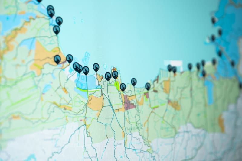
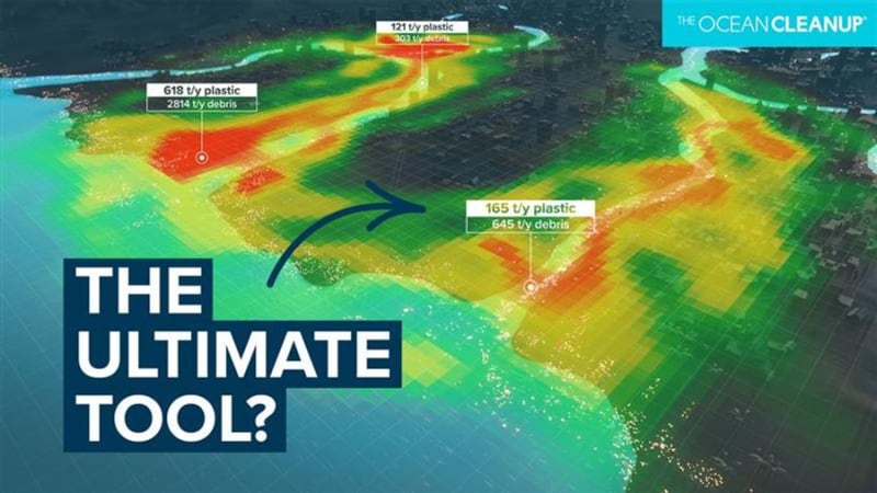
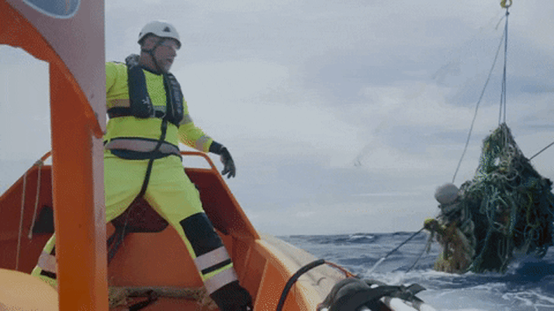
The Ocean Cleanup has launched its Smart River Survey, a comprehensive mapping system that combines drones, AI-powered cameras, GPS drifters, and satellite data to track plastic pollution through city waterways. The technology creates interactive maps that show decision-makers exactly where trash enters rivers and which locations would benefit most from cleanup systems.
Before deploying any cleanup equipment, The Ocean Cleanup spends months researching each river's unique pollution patterns. They work closely with local authorities and communities to understand how waste moves through the water and where interventions will make the biggest difference.
The survey process marks a major shift in how cities can tackle river pollution. Instead of guessing where to place cleanup systems, officials now get measurable data showing pollution hotspots and flow patterns. The maps don't just identify problems; they also highlight the most effective places to deploy solutions.
The technology package includes AI-enhanced cameras that automatically detect and count plastic items, GPS drifters that follow water currents to show how trash travels, and drone footage that captures bird's-eye views of pollution patterns. Local partners add crucial context about each city's specific challenges.
This data-driven approach is essential for The Ocean Cleanup's ambitious 30 Cities Program, which aims to stop plastic from reaching oceans by intercepting it in rivers. The system needs to be fast, efficient, and replicable across diverse locations from Southeast Asia to Latin America.
The Ripple Effect
The Smart River Survey represents something bigger than just better maps. It gives communities concrete evidence to drive action and helps cities compare notes on what works. When one city discovers an effective placement strategy, others can learn from that success.
The framework also empowers local governments with the information they need to justify cleanup investments and track progress over time. Cities can show residents measurable improvements in water quality and plastic reduction.
With 80,000 people now following The Ocean Cleanup's mission updates, public engagement is growing alongside the technical solutions. Communities want to see their rivers cleaned, and now they have the data to make it happen strategically.
Every river mapped brings us closer to oceans free of plastic pollution.
More Images
Based on reporting by Google News - Ocean Cleanup
This story was written by BrightWire based on verified news reports.
Spread the positivity!
Share this good news with someone who needs it