Scientists Map 30,000 Hidden Hills Under Antarctica's Ice
Scientists created the most detailed map ever of Antarctica's hidden landscape, revealing over 30,000 uncharted hills beneath miles of ice. This breakthrough will help predict how quickly ice will melt and contribute to sea-level rise.
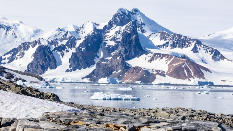
Scientists just unveiled what lies beneath Antarctica's massive ice sheet, and the hidden world they discovered looks nothing like a frozen wasteland.
Using cutting-edge satellite technology, researchers mapped the entire continent's subglacial terrain for the first time. They found towering mountain ranges, deep canyons, wide valleys, and over 30,000 hills no one knew existed.
The team combined high-resolution satellite images with a technique called ice-flow perturbation analysis. This method reads tiny bumps and dips on the ice surface to figure out what terrain lies beneath, filling in gaps that traditional radar surveys miss.
Antarctica is roughly half the size of Africa, and its landscape is just as dramatic. The ice sheet covering it averages 1.3 miles thick and reaches up to 3 miles deep in some spots, hiding 70% of Earth's freshwater.
"The hidden landscape of Antarctica contains vast extremes," said glaciologist Robert Bingham of the University of Edinburgh, who helped lead the study published in Science. "Boring it is not."
Before this map, scientists had better knowledge of Mars' surface than what lay under Antarctica's ice. Traditional radar surveys left gaps as wide as 93 miles between scans, making it impossible to see how landscape features connected.
The Ripple Effect
This detailed map does more than satisfy curiosity about Earth's last frontier. It's a game-changer for predicting climate impacts that affect everyone.
The shape of the bedrock controls how fast ice flows toward the ocean. Rough terrain with jagged hills and mountaintops creates friction that slows ice retreat, while smooth plains let ice slide faster.
Climate scientists can now build better models to forecast sea-level rise. The improved data will help the U.N.'s Intergovernmental Panel on Climate Change provide governments with more accurate information for shaping climate policies.
The map also shows researchers exactly where they need to conduct detailed field surveys and where satellite data already tells the complete story. This saves time and resources while advancing our understanding of how Antarctica's ice sheet will respond to warming temperatures.
Antarctica wasn't always frozen. The continent developed its ice covering over 34 million years ago, long after its dramatic landscape formed. The newly revealed terrain matches landscapes found in Scotland, Scandinavia, northern Canada, and Greenland, giving scientists confidence in their mapping technique.
Better predictions about Antarctica's ice mean better preparation for coastal communities worldwide facing rising seas.
More Images


Based on reporting by Google News - Science
This story was written by BrightWire based on verified news reports.
Spread the positivity! 🌟
Share this good news with someone who needs it