Scientists Map Hidden World Beneath Antarctica's Ice
A groundbreaking map reveals mountains, valleys, and ancient river channels hiding beneath Antarctica's ice sheet in unprecedented detail. This discovery could help scientists better predict how our planet responds to climate change.
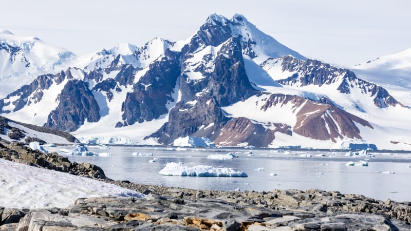
Scientists just unveiled the most detailed map ever created of the hidden world beneath Antarctica's ice, revealing an entire landscape that's been frozen in time for millions of years.
The new map shows features buried up to 18 miles deep under the ice sheet, including previously unknown mountain ranges, valleys stretching hundreds of miles, and sharp terrain transitions that suggest ancient tectonic boundaries. Some of what researchers found surprised them: in one region where they expected an ancient river landscape, they discovered deep valleys instead.
Creating this map was no small feat. Antarctica's ice sheet covers more than 5.4 million square miles, making the terrain beneath it one of the least mapped surfaces in our inner solar system.
The research team combined high-resolution satellite images with ice thickness measurements and physics-based analysis of how ice flows over bedrock. This approach filled critical gaps that traditional ground and air surveys missed, especially the valleys and channels that guide ice movement.
Why does a map of buried terrain matter? Because what's underneath directly shapes what happens on top.
These hidden mountains, valleys, and basins control how glaciers flow and change. Understanding this relationship helps scientists create better models for predicting ice melt and sea level rise as our planet warms.
The Ripple Effect
The implications reach far beyond Antarctica. More accurate predictions of ice sheet behavior mean coastal communities worldwide can better prepare for future sea level changes.
The map also reveals traces of what Antarctica looked like before ice covered it. Those ancient river channels stretching for hundreds of miles offer glimpses into a warmer, greener past that could inform our understanding of Earth's climate history.
Scientists can now observe how the ice sheet has evolved over time and how it interacts with the bedrock below. Each valley, ridge, and basin tells part of the story of how our planet's frozen continent came to be.
The research represents years of collaboration and cutting-edge technology coming together to illuminate one of Earth's last great mysteries. What was once hidden in darkness now stands revealed in stunning detail.
This breakthrough transforms our ability to understand and protect one of the most important regions on Earth.
More Images


Based on reporting by Live Science
This story was written by BrightWire based on verified news reports.
Spread the positivity! 🌟
Share this good news with someone who needs it