Scientists Map Antarctica's Hidden Landscape in Detail
For the first time, researchers have created a high-resolution map revealing tens of thousands of hidden features beneath Antarctica's ice sheet. The discovery includes a massive 250-mile channel and could transform how we understand ice movement and climate change.
Antarctica just revealed secrets that have been hiding beneath miles of ice for millions of years, and what scientists found is reshaping everything we thought we knew about Earth's most mysterious continent.
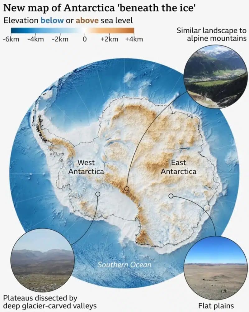
Researchers at Grenoble Alpes University have created the most detailed map ever of Antarctica's buried landscape. Using satellite data combined with ice flow modeling, they uncovered tens of thousands of hills, ridges, and valleys that were invisible until now.
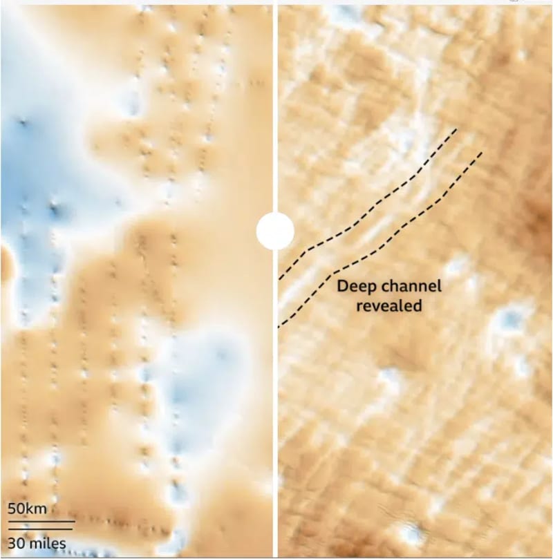
The team discovered something massive: a bedrock channel stretching almost 250 miles across the Maud Subglacial Basin. The formation measures nearly 4 miles wide and plunges 160 feet deep, yet no one had seen it in such detail before.
Lead author Helen Ockenden says the difference is like upgrading from a grainy film camera to a high-definition digital image. Previous maps relied on radar surveys that left gaps hundreds of miles wide between flight lines, forcing researchers to guess what lay in between.
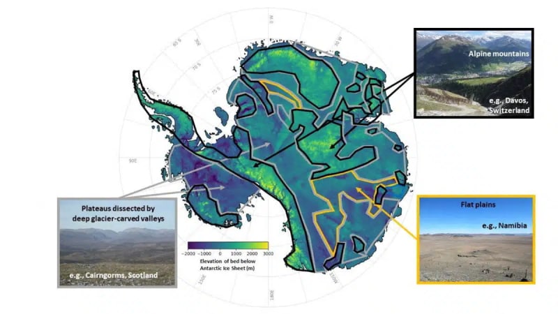
This new approach fills those blind spots completely. The continuous view reveals mountain ranges, glacier-carved valleys, and surprisingly flat basins that directly influence how ice moves above them.
Peter Fretwell from the British Antarctic Survey calls it "a really useful product" that finally lets scientists see the complete picture. Understanding the terrain beneath the ice is crucial for predicting how glaciers will behave as our planet warms.
Why This Inspires
The emotional reaction from researchers tells you everything you need to know about this breakthrough. Professor Robert Bingham from the University of Edinburgh said he was "just so excited" to see the whole bed of Antarctica at once after years of studying fragments.
Ockenden compared the experience to seeing Mars topography for the first time. Some landscapes look familiar, like Scotland's highlands, while others resemble nothing on Earth's surface.
This isn't just about filling gaps on a map. These hidden features control where ice speeds up or slows down, which directly affects sea level predictions for coastal cities worldwide. The detailed terrain data will help scientists model future ice sheet behavior with unprecedented accuracy.
The map brings together decades of fragmented research into one coherent image. Antarctica, shrouded in mystery beneath two miles of ice in some places, is finally showing its true shape.
After centuries of exploration, we're seeing Earth's coldest continent with fresh eyes and discovering it's far more complex and fascinating than anyone imagined.
More Images
Based on reporting by Google News - Science
This story was written by BrightWire based on verified news reports.
Spread the positivity!
Share this good news with someone who needs it