Scientists Map Hidden Caves That Keep Grand Canyon Alive
Researchers have created the first detailed 3D maps of secret underground caves that supply all drinking water for millions of Grand Canyon visitors. Their discoveries could protect this vital water source from drought and contamination as the region grows hotter and drier.
Every visitor to the Grand Canyon depends on water from a single hidden spring, and scientists just mapped the underground world that keeps it flowing.
Roaring Springs, a cave-fed water source on the North Rim, supplies every water fountain and refill station in Grand Canyon National Park. The spring provides water for millions of annual visitors, plus the plants, animals, and ecosystems throughout the canyon.
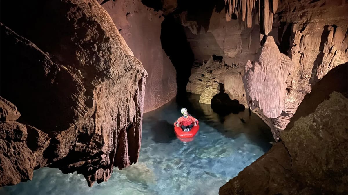
Researchers at Northern Arizona University spent 45 days exploring and mapping over six miles of underground passages that have never been open to the public. Using mobile lidar scanners, they created the first high-resolution 3D maps of these cave systems, revealing chambers, passages, and fracture patterns in remarkable detail.
The work wasn't easy. Team members hiked up to two days carrying 55-pound packs of equipment to reach remote cave entrances. Once inside, they climbed, rappelled, crawled, and even floated through flooded sections to document every inch of the hidden network.
The maps are already solving mysteries about how water travels underground. Previous studies showed that snowmelt from the Kaibab Plateau can move through the rock and emerge at Roaring Springs in as little as one week, traveling roughly 12 miles underground.
Understanding these pathways matters for more than scientific curiosity. The cave systems work like Swiss cheese, with holes and channels that let water move quickly but offer little natural filtration. That means contaminants from wildfires or bacteria could reach the water supply fast.
The Ripple Effect
The research gives park managers crucial information to protect the water supply that sustains the entire Grand Canyon ecosystem. As the Southwest faces hotter temperatures and less snowfall, knowing exactly how water moves underground helps officials make better decisions about conservation and contamination risks.
The detailed 3D maps now serve as a baseline to track changes over time. Scientists can monitor how springs respond to drought, measure water flow patterns, and identify potential threats before they become emergencies.
This underground network has sustained life in the Grand Canyon for thousands of years, and now scientists finally have the tools to help protect it for thousands more.
Based on reporting by Science Daily
This story was written by BrightWire based on verified news reports.
Spread the positivity!
Share this good news with someone who needs it