Scientists Map Landslide Risks to Protect Communities
After devastating landslides in New Zealand, researchers are revealing how better mapping and science can save lives by predicting where slopes might fail. Their work shows that understanding nature's warning signs can help communities stay safe.
Scientists are turning tragedy into protection by mapping landslide risks across New Zealand, helping communities understand and prepare for unstable slopes before disaster strikes.
Following a fatal landslide at Mount Maunganui last week, researchers are sharing crucial insights about what causes slopes to fail and how communities can identify danger zones. Their work reveals that nature often leaves visible clues about where land might collapse during heavy rain.
The Tauranga region sits on volcanic materials that weather into clay-rich soils over time. When heavy rainfall soaks these soils, water pressure builds between soil particles, weakening the ground's strength and triggering landslides.
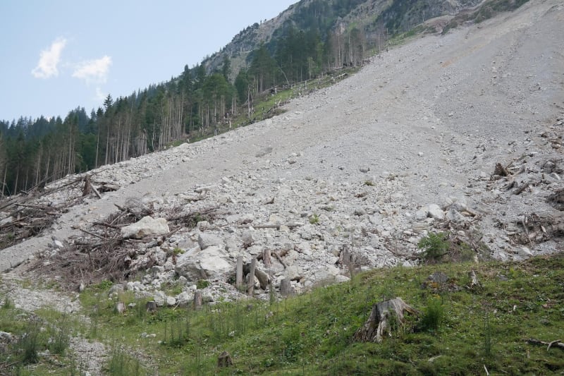
Following extreme weather events in 2023, Tauranga City Council created detailed landslide susceptibility maps that let residents see which areas are most vulnerable. These maps show "relic slips," ancient landslides that leave lasting marks on the landscape and signal where failures might happen again.
University of Auckland researchers studied Mount Maunganui after Cyclone Wilma dumped 108mm of rain in 24 hours during 2011. They documented at least 80 landslides from that single storm, with some debris flows traveling 120 meters downslope.
The science of trees and slopes turns out to be more complex than many realize. Tree roots typically strengthen soil and their canopies slow rainfall, which is why forest harvesting often triggers landslides in New Zealand. But trees can also destabilize slopes under certain conditions, especially during extreme winds when they act like sails in saturated soil.
The Bright Side
This research is giving communities powerful tools to protect themselves. Landslide susceptibility mapping allows people to make informed decisions about where to build, live and recreate. Historical aerial imagery dating back to 1943 helps scientists identify patterns and predict future risks.
Understanding that landslides result from multiple factors—geology, rainfall patterns, land use and vegetation—means communities can take targeted prevention steps. Rather than searching for single causes after tragedy strikes, scientists are building comprehensive risk profiles that account for how different elements interact.
The knowledge gained from studying past events is helping protect future lives. When communities know which slopes are vulnerable, they can implement early warning systems, adjust land use practices and make evidence-based decisions about development.
Science is transforming how we live safely alongside nature's more volatile forces.
More Images


Based on reporting by Phys.org
This story was written by BrightWire based on verified news reports.
Spread the positivity!
Share this good news with someone who needs it