Europe's Free Satellite Tool Now Tracks Wildfires in Detail
Anyone can now monitor wildfires worldwide for free with Europe's upgraded satellite service that shows active fires, burning vegetation, and scorched earth in vivid detail. The new feature makes cutting-edge wildfire tracking accessible to everyone from firefighters to concerned citizens.
Tracking wildfires just became easier for anyone with internet access, thanks to a major upgrade to Europe's free satellite imaging service.
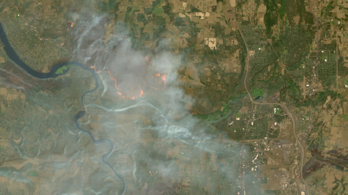
The Copernicus Browser, which provides free access to satellite imagery from the European Space Agency's Sentinel satellites, added a powerful wildfire visualization layer on August 4. The new feature displays active fires in white or yellow, burning vegetation in red, and already-burned landscapes in dark brown or black.
The upgrade transforms how people can monitor wildfires around the globe. The Sentinel-2 satellites capture images at resolutions as detailed as 10 meters in visible light and near-infrared bands, making them far more detailed than many alternatives.
Remote sensing expert Pierre Markuse created the original wildfire visualization script in JavaScript nearly a decade ago. His script cleverly combines three different light bands: red visible light, narrow near-infrared to show the difference between healthy and burned vegetation, and short-wave infrared to reveal moisture levels in scorched soil.
For years, users could manually add Markuse's script to their Copernicus Browser sessions by copying and pasting code. But Simon Proud, mission scientist for Sentinel-2 at the European Space Agency, pushed to make the tool a default option so everyone could access it with a simple click.
The timing couldn't be more crucial. Wildfires are intensifying across the world as climate change extends and worsens traditional fire seasons.
Washington and Oregon are currently battling wildfires and smoke, while Canada faces one of its worst wildfire seasons on record. In Europe, firefighters continue battling blazes in France and Spain, where hundreds of thousands have evacuated during a record-breaking season.
Why This Inspires
This upgrade democratizes wildfire monitoring in a way that matters. While NASA's FIRMS tool offers global fire detection updated within hours, its resolution only goes down to 250 meters. Sentinel-2 updates every few days but provides images 25 times more detailed in certain bands.
That precision makes it arguably the best free tool available for high-resolution satellite imagery of wildfires and other disasters. Emergency responders, journalists, researchers, and concerned community members now have the same powerful monitoring capability at their fingertips.
The story shows how a single expert's innovation, combined with an agency willing to make it accessible, can create tools that help protect communities worldwide.
As wildfires become more frequent and severe, having free, detailed, publicly available monitoring tools gives everyone a better chance to prepare, respond, and stay safe.
More Images



Based on reporting by Ars Technica
This story was written by BrightWire based on verified news reports.
Spread the positivity!
Share this good news with someone who needs it