Ghana Trains 22 Leaders to Use Satellite Data for Climate
Ghana just equipped 22 government and business leaders with satellite technology skills to tackle illegal mining, deforestation, and water crises. The training marks a major step toward using space-based tools for real-world environmental solutions.
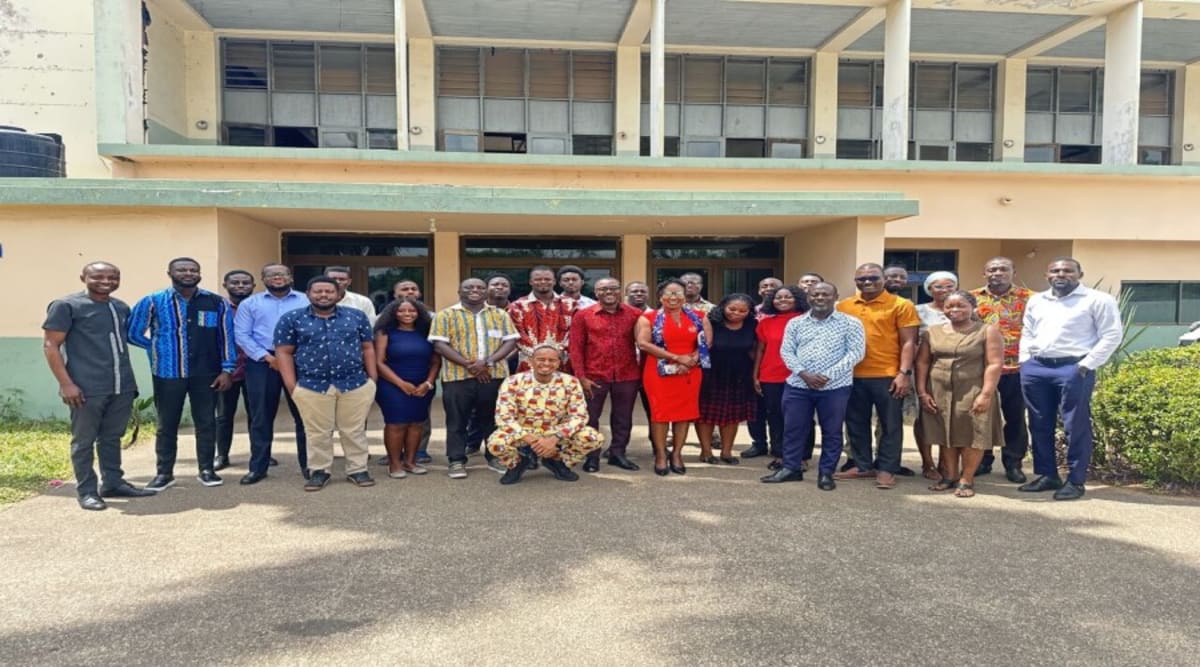
Stakeholders across Ghana are now armed with powerful satellite technology to fight environmental damage and plan smarter development, thanks to a groundbreaking workshop in Accra.
Twenty-two representatives from government agencies, research institutions, and private companies spent two days learning how to harness Earth observation data for decision-making. Digital Earth Africa and the Ghana Space Science and Technology Institute led the training, focusing on practical applications that address Ghana's most urgent challenges.
Participants dove into hands-on exercises covering crop health monitoring, water resource management, coastal erosion tracking, and detecting illegal surface mining. The training introduced them to Digital Earth Africa's free platform, making advanced satellite tools accessible without expensive technology barriers.
The timing couldn't be better. Ghana faces mounting pressure from "galamsey" (illegal mining operations) that devastate forests and pollute river systems. Several institutions identified satellite monitoring as a game-changer for tracking these destructive activities in real time.
The Ghana Cocoa Board highlighted another critical application. European Union regulations now require proof that cocoa exports don't contribute to deforestation. Satellite-based traceability systems offer a transparent way to meet these standards while protecting Ghana's forests.
The Ghana Statistical Service sees opportunity too. Higher-resolution satellite imagery could dramatically improve mapping accuracy for the 2030 national census, ensuring better resource allocation and planning.
The Ripple Effect
This workshop plants seeds that could grow across West Africa. The Ghana Space Science and Technology Institute is positioning itself as a regional hub for Earth observation adoption, particularly in universities and research centers.
Follow-up activities are already planned. Additional training sessions, on-site technical support, and expanded university partnerships will help scale these tools beyond the initial 22 participants. As more institutions adopt satellite monitoring, Ghana builds a network of data-informed decision-makers tackling climate resilience and sustainable development.
The shift from reactive to proactive environmental management starts with knowledge, and Ghana just invested in 22 new champions of that change.
Based on reporting by Google News - Ghana Development
This story was written by BrightWire based on verified news reports.
Spread the positivity!
Share this good news with someone who needs it