Lasers Map 200,000 Trees to Fight Climate Change
Scientists just created the most detailed 3D forest scans ever recorded, measuring over 200,000 trees across three continents to track how forests fight climate change. The groundbreaking data will help satellites monitor Earth's forests more accurately than ever before.
Scientists have built something remarkable: a digital twin of tropical rainforests so detailed you can see the shape of individual tree branches from space.
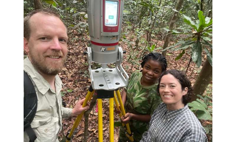
Researchers from University College London led an international team that used lasers and drones to create 3D scans of nearly 550 hectares of tropical rainforest across French Guiana, Gabon, and Malaysia. They measured more than 200,000 trees, then hand-tagged and ground-scanned 7,000 more for extra precision.
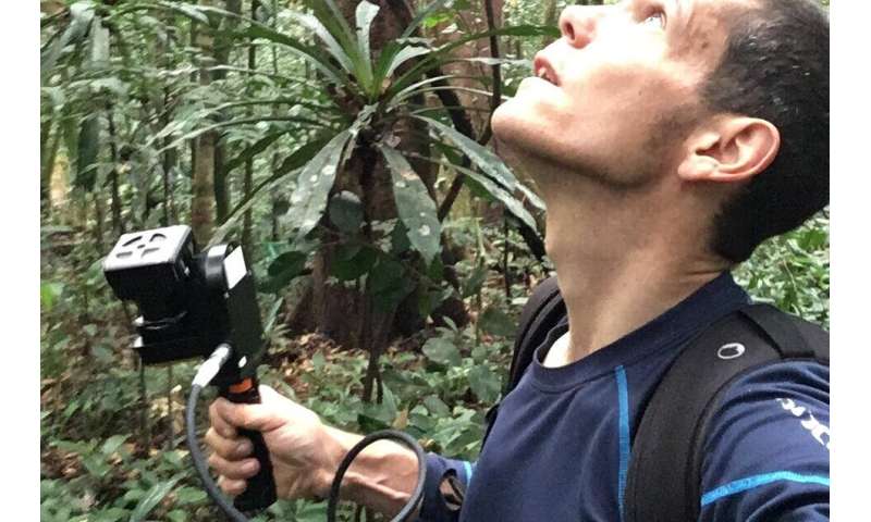
The project, called ForestScan, combines three types of laser scanning. Ground-based lasers scan trees from below, while drones fly overhead capturing aerial views. Planes equipped with lasers map vast areas from high altitudes, creating a complete picture from every angle.
Local scientists in each country measured tree trunks with tape measures and recorded species, building what lead researcher Dr. Cecilia Chavana-Bryant calls "one of the most detailed datasets ever collected for tropical forests." The painstaking work took years but created something invaluable: a benchmark that satellites can use to improve their own forest monitoring.
Why does this matter? Forests are climate superheroes. Trees pull carbon dioxide from the atmosphere and store it in their trunks and branches. About half of a living tree's mass is carbon that used to be warming our planet.
But until now, scientists struggled to measure exactly how much carbon forests store. Satellites can see forests from space, but they need ground truth data to interpret what they're seeing. These 3D scans provide that truth.
The Ripple Effect
This work helps everyone trying to protect forests and fight climate change. Satellites can now use these precise measurements to refine their algorithms, making global forest monitoring more reliable. Scientists gain tools to track how forests respond to rising temperatures. Policymakers get accurate data for conservation decisions. Local communities preserving their forests can prove the carbon value of their efforts.
The team is already expanding their network of reference sites worldwide, creating a global standard for measuring forest health. Other researchers can use their methods and data freely, accelerating forest science everywhere.
Dr. Chavana-Bryant emphasizes the collaborative spirit that made this possible: "It would not have been possible without the support of our collaborators in each region."
Now we can watch over the world's forests with unprecedented clarity, giving us the knowledge we need to protect them.
More Images


Based on reporting by Phys.org - Earth
This story was written by BrightWire based on verified news reports.
Spread the positivity!
Share this good news with someone who needs it