NASA Satellite Maps South Africa's Food Bowl From Space
A new NASA satellite is painting digital portraits of South Africa's farmland, helping scientists track food production in the crucial Maize Triangle region. The technology could revolutionize how the world monitors crops and responds to changing climate patterns.
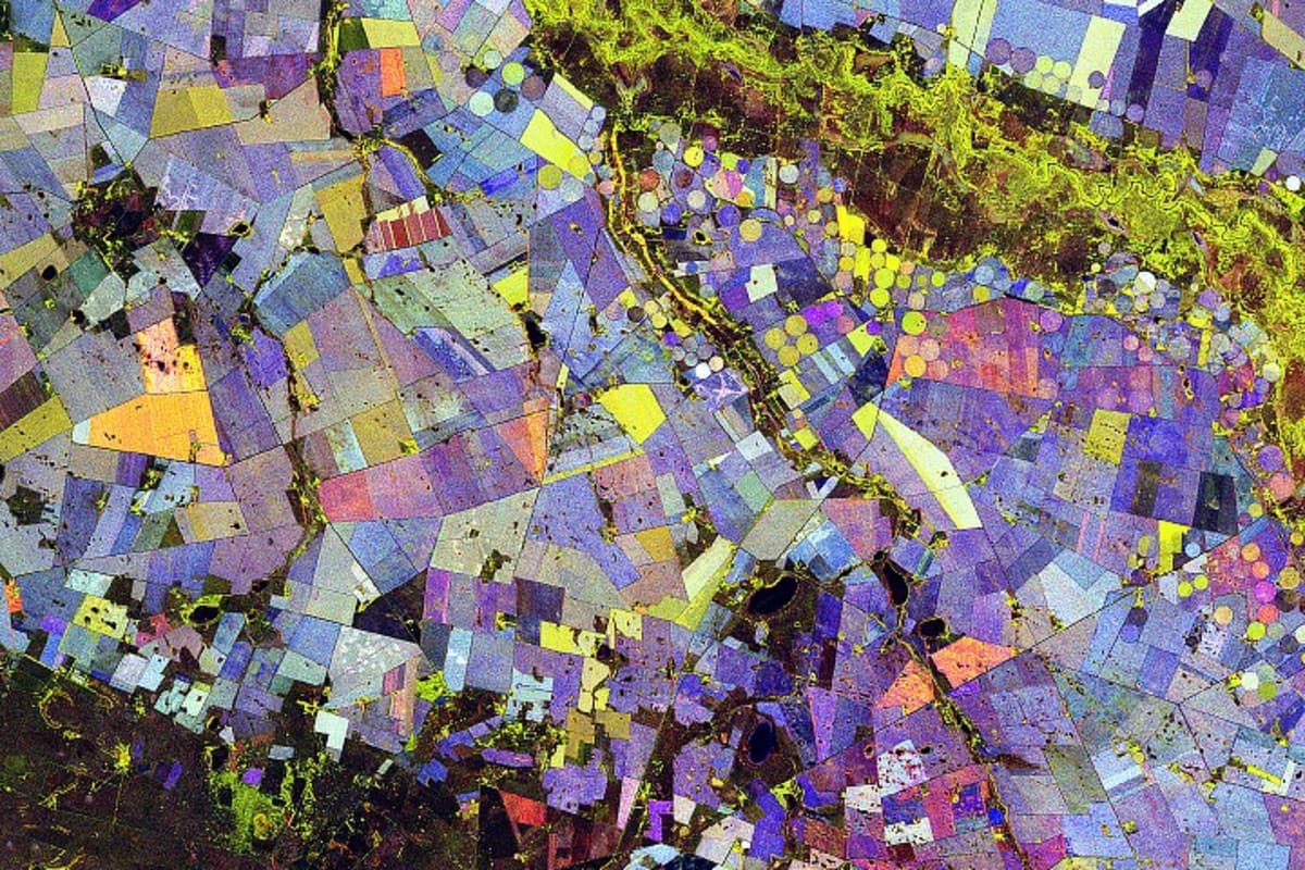
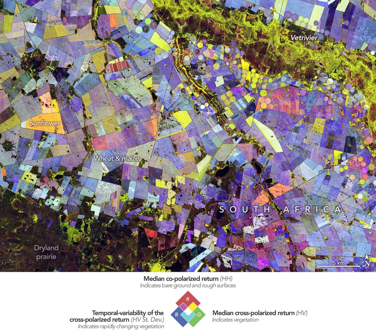
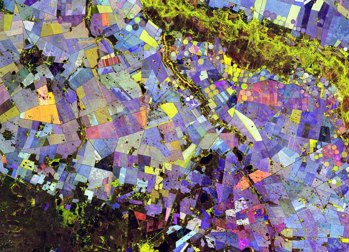
A cutting-edge satellite has turned farmland along South Africa's Vet River into what looks like a modern art masterpiece, but the vibrant colors reveal something far more valuable than beauty.
The NISAR satellite, a joint project between NASA and India's space agency, captured stunning images of the Maize Triangle between November 2025 and March 2026. The region feeds millions across southern Africa, making every crop cycle critical to food security.
Unlike regular satellites that photograph landscapes in visible light, NISAR uses radar to see the actual structure of plants. This means it can distinguish between corn, wheat, and sunflowers based on how they grow, not just what color they appear.
The colorful circles and rectangles in the images aren't random. Green shows healthy vegetation, red marks bare soil or harvested fields, and blue reveals how quickly plants changed throughout the season.
Forests appear light blue because they stay mostly the same, while crops like corn show darker blue as they sprout, grow tall, and get harvested. Orange fields likely contain sunflowers, which grow fast and get cut early in the season.
The farmland sits about 70 miles north of Bloemfontein in the Free State province, a semi-arid area transformed by irrigation from the Vet River. This water brings life to fields that would otherwise struggle in the dry climate.
The Ripple Effect
Paul Siqueira, a scientist at the University of Massachusetts Amherst leading the NISAR ecosystems team, explains the technology offers much more than pretty pictures. Scientists can now monitor crop health across entire regions, spot irrigation problems, and track how fields respond to droughts or floods.
As NISAR continues circling Earth, researchers will compare growing seasons year after year. Farmers and governments could get early warnings about crop failures, helping them respond before food shortages develop.
The system works by sending radar signals to Earth and measuring how they bounce back. Different plant structures reflect the signals differently, creating a unique signature for each crop type.
The breakthrough matters especially now, as climate change makes weather patterns less predictable and food security more fragile. Having eyes in the sky that can see through clouds and darkness gives scientists a constant watch over farmland.
NISAR will keep collecting data, building a detailed history of agricultural patterns across the globe. The Maize Triangle is just the beginning of a revolution in how humanity monitors the crops that feed billions.
More Images

Based on reporting by NASA
This story was written by BrightWire based on verified news reports.
Spread the positivity!
Share this good news with someone who needs it