Nebraska Launches Wildfire Recovery Hub After 1M Acres Burn
After nearly 1 million acres of grasslands burned this spring, University of Nebraska scientists launched a free online tool to help ranchers track recovery using 40 years of wildfire data. The platform combines decades of research with real-time monitoring to guide farmers through the long road ahead.
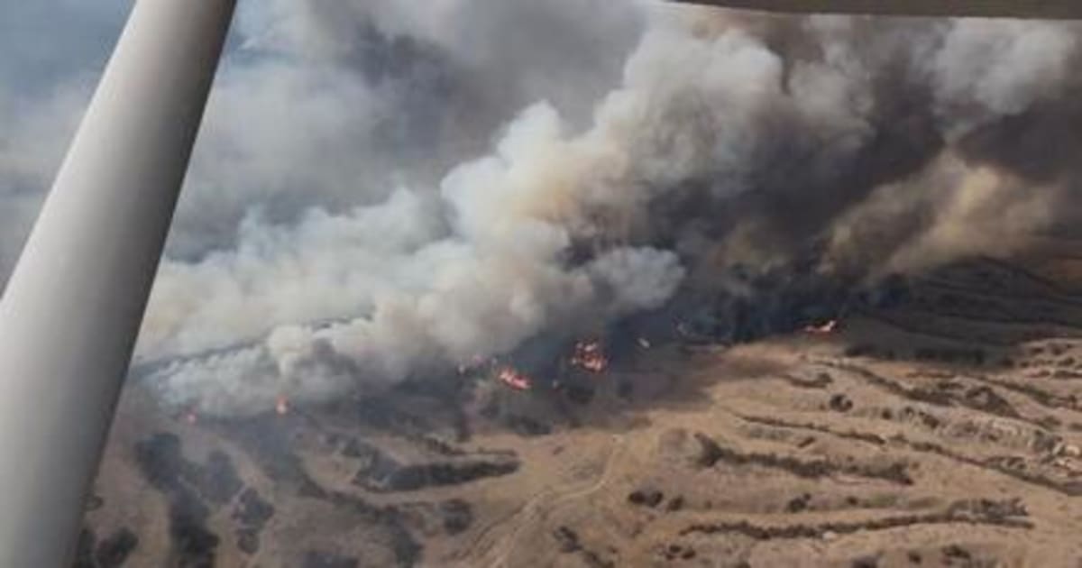
When historic wildfires tore through nearly 1 million acres of Nebraska grazing lands this spring, ranchers faced a daunting question: how long until the land recovers?
Scientists at the University of Nebraska-Lincoln just gave them a powerful answer. They launched wildfire.unl.edu, the first online hub designed specifically to help farmers and ranchers track grassland recovery after fires.
The free platform does something remarkable. It combines 40 years of wildfire data with satellite vegetation monitoring, showing ranchers exactly how similar fires recovered in the past and what to expect on their own land.
"Wildfire recovery unfolds over years, not months," said Dirac Twidwell, a rangeland ecologist at Nebraska. "What we've built here is not just a map of fires. It's a system that helps people understand recovery, anticipate change and respond with better information."
Twidwell's team spent decades building one of the most comprehensive wildfire datasets in the Great Plains. They cataloged more than 1,300 fires across the region since 1985, tracking how grasslands responded under different weather patterns and management decisions.
Now that knowledge lives in one accessible place. Ranchers can explore where fires happened across Nebraska dating back to 1985, view detailed perimeters and sizes, and watch graphs showing how vegetation bounced back over time.
The tool goes beyond just looking backward. It connects users directly to Nebraska Extension educators, upcoming workshops and technical experts who can guide recovery decisions on the ground.
The platform launched at a critical moment. University research shows large wildfires are increasing across Nebraska and the Great Plains, making long-term recovery planning more important than ever.
The Ripple Effect
This hub represents a shift in how science serves communities facing climate challenges. Instead of keeping research locked in academic journals, Nebraska scientists built a bridge between decades of data and the people who need it most.
Farmers and ranchers can now make decisions based on patterns observed across hundreds of fires and thousands of acres. They can see that recovery timelines vary widely, helping them set realistic expectations and plan accordingly.
The platform also creates a feedback loop. As landowners use the tool and share their own observations, researchers can refine recovery predictions and improve guidance for future fires.
Nebraska Extension educators can now coordinate their support more effectively, connecting ranchers facing similar challenges and organizing field days where successful recovery strategies are shared.
One website is helping an entire state's agricultural community face an uncertain future with better information, stronger networks and evidence-based hope.
More Images


Based on reporting by Google News - Wildlife Recovery
This story was written by BrightWire based on verified news reports.
Spread the positivity!
Share this good news with someone who needs it