New Map Reveals 13x Great Lakes' Worth of U.S. Groundwater
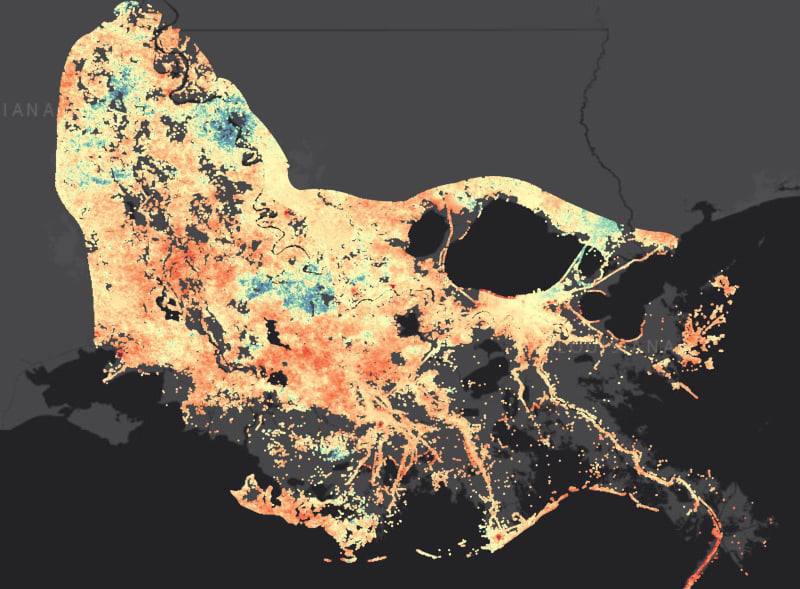
Scientists created the first detailed map showing exactly where America's groundwater sits, revealing 306,000 cubic kilometers of fresh water beneath our feet. The breakthrough combines artificial intelligence with over a million real measurements to help communities manage water supplies down to a 98-foot resolution.
America has more than 13 times the volume of the Great Lakes hidden beneath its surface, and scientists just figured out exactly where it all is.
Researchers at Princeton University and the University of Arizona created the most detailed groundwater map ever made for the continental United States. Their breakthrough reveals 306,000 cubic kilometers of fresh water and shows precisely where communities can find it.
The challenge was enormous because most of Earth's fresh water sits underground, invisible to satellites and traditional monitoring. For decades, scientists could only make educated guesses based on rainfall and evaporation patterns.
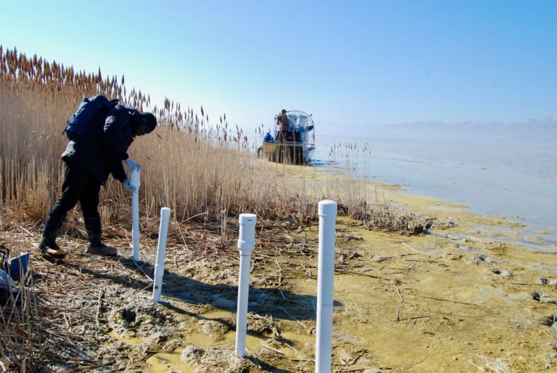
The team solved this puzzle by combining more than a million direct measurements from monitoring wells with artificial intelligence. They trained algorithms to predict groundwater depth at locations where no measurements existed, creating a grid of over 8 billion squares across the country.
Each square measures just 30 meters on each side, about the length of three school buses. That's more than 1,000 times more detailed than previous maps, which could only show water levels at roughly one-kilometer resolution.
"Given all the things we do know about the planet, we don't actually know how much water we have," said Reed Maxwell, the study's senior author and professor at Princeton. "Since most of it's in groundwater, that's where this becomes a hard problem."
The map revealed surprising pockets of shallow groundwater that nobody knew existed. It also hints at where agricultural pumping has depleted underground reserves, though more monitoring would paint a clearer picture of those trends.
The new approach uses far less computing power than traditional physics-based models. It also calculates uncertainty at each location using a method called random forest, which runs 300 slightly different decision trees to solve the same problem and compares their answers.
The Ripple Effect
Communities facing water scarcity now have precise data to guide decisions about irrigation, conservation, and infrastructure. Cities can better plan where to drill wells, farmers can understand their long-term water security, and environmental managers can protect critical ecosystems.
The research, published in Communications Earth & Environment, provides a foundation for regional planning across the country. The data-driven method proves that artificial intelligence can help solve problems that were too complex or expensive to tackle through traditional means alone.
Fresh water sustains everything from drinking supplies to food production, and knowing exactly where it sits underground transforms how communities prepare for drought and growth. This map turns an invisible resource into something planners can actually see and protect for generations ahead.
More Images


Based on reporting by Phys.org - Earth
This story was written by BrightWire based on verified news reports.
Spread the positivity! 🌟
Share this good news with someone who needs it