New Satellites Spot Garage-Sized Fires From Space
A new constellation of fire-spotting satellites can detect wildfires as small as half an acre before they spiral out of control. The first three launch next month, with 50 planned by 2030 to check every spot on Earth every 20 minutes.
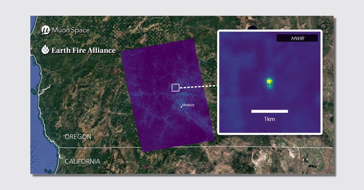
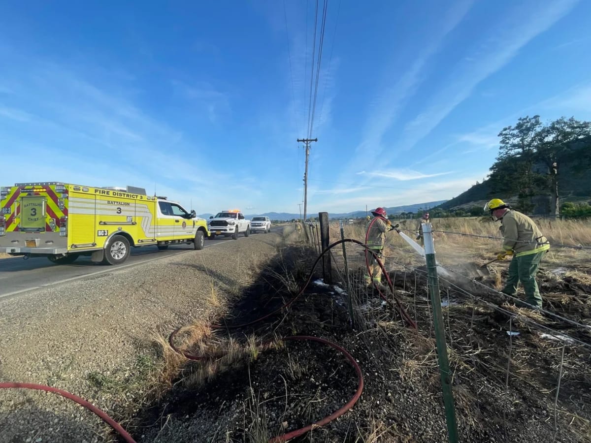
When a grass fire ignited beside an Oregon road last summer, it was barely half an acre—too tiny for regular satellites to catch, but big enough to become a disaster. A new satellite system called FireSat spotted it instantly, proving that catching wildfires early might finally be possible.
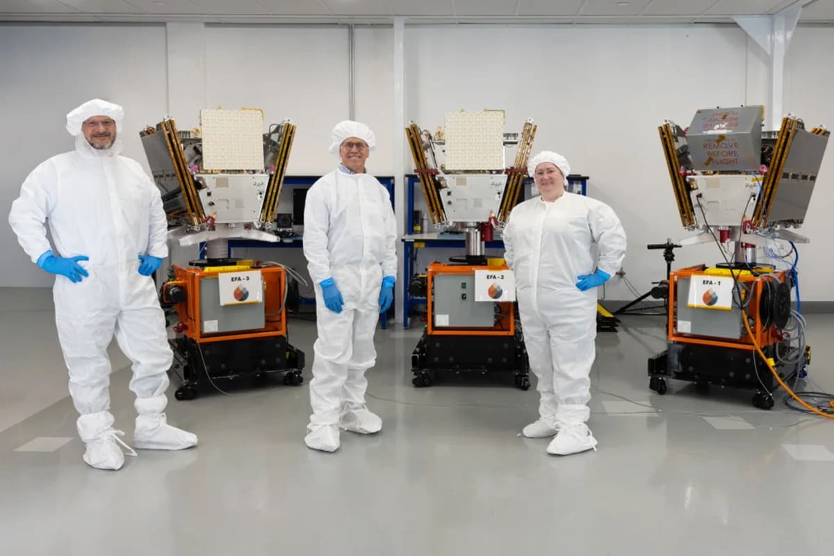
Thanks to a $26 million grant from the Bezos Earth Fund, three FireSat satellites launch next month to start tracking fires worldwide. By 2030, Earth Fire Alliance plans to have 50 satellites circling the planet, checking every location every 20 minutes.
The nonprofit behind FireSat talked to more than 200 fire agencies, land managers, and policymakers before designing the system. "The biggest theme that kept coming up was better data to truly understand the scope and scale of wildfire across the planet," says Brian Collins, the organization's executive director.
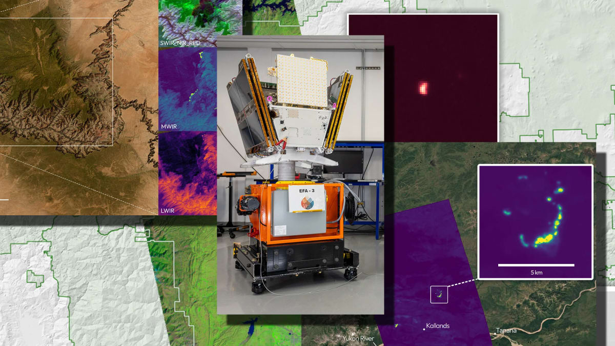
Current weather satellites can spot some fires, but they weren't built for that job. FireSat's satellites, designed by Muon Space, see beyond visible light using four different wavelengths that each reveal something unique about fire behavior.
Short-wave infrared cuts through smoke to see what's underneath. Mid-wave infrared detects both raging flames and slow burns, while long-wave infrared measures ground temperature and near infrared shows how vegetation responds to fire.
The system can spot fires as small as a garage in high resolution. It can also tell the difference between an actual fire and sunlight bouncing off a metal roof, eliminating false alarms that waste precious response time.
FireSat works alongside other tools like cameras, filling in the gaps where cameras fall short. Cameras can catch fires quickly but struggle to pinpoint smoke location without multiple angles, and thick smoke can block their view entirely while satellites keep tracking the fire's movement.
The Ripple Effect
Fire agencies from Colorado to Australia are already partnering on the project. In the Amazon rainforest, where fires often burn for 24 hours before anyone notices, FireSat could slash response times dramatically.
The system tracks low-intensity fires that don't need intervention, building a comprehensive picture of wildfire activity that scientists have never had before. Today, only the largest fires get reported, leaving huge knowledge gaps in fire science.
FireSat is also creating a global network where fire agencies share strategies across continents. A team battling blazes in California can now swap insights with firefighters in Portugal, turning local knowledge into worldwide wisdom.
Soon, the fires that devastate communities might be stopped when they're still small enough to fit in your backyard.
More Images

Based on reporting by Fast Company - Innovation
This story was written by BrightWire based on verified news reports.
Spread the positivity!
Share this good news with someone who needs it