New Wildfire Tech Helps Utilities Protect Neighborhoods
Electric utilities can now predict wildfire risk down to individual neighborhoods instead of entire counties, preventing fires before they start. The technology is helping companies protect homes while keeping the lights on.
Imagine knowing exactly which street corner faces wildfire danger at 3 p.m. tomorrow, not just which county might be at risk. That precision is now possible for electric companies fighting to prevent devastating wildfires.
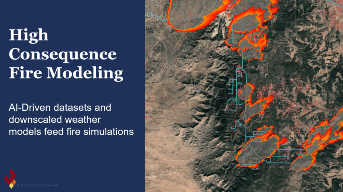
Public Service Company of New Mexico is using new geospatial technology called Firescape to pinpoint wildfire threats at the neighborhood level. The approach replaces old county-wide warnings with block-by-block accuracy, letting field crews protect specific areas without shutting off power to thousands of customers unnecessarily.
"This technology enables utilities to get really granular about where there is high fire risk and what preventative actions they can take," said Holly Eagleston, CEO and founder of Firescape. The system can even predict specific times of day when danger peaks.
Traditional wildfire prevention relied on National Weather Service Red Flag Warnings that cover entire counties. That broad approach forced utilities to make tough choices between safety and keeping power flowing to communities.
Now utilities feed high-resolution data directly into their distribution management systems. The technology gives operators real-time visibility to adjust safety settings for a single neighborhood while normal service continues everywhere else.
The shift from reaction to prevention extends beyond emergency response. These detailed analytics help utilities plan long-term improvements by calculating exactly how much risk each potential upgrade would reduce per dollar spent.
"How much risk are you avoiding by each mitigation strategy?" Eagleston explained. "We use granular analytics to model every candidate mitigation action, from replacing fuses to installing covered conductor, by the risk it buys down per dollar."
The data-driven approach helps utilities build stronger cases when requesting funding from regulators. Instead of guessing which infrastructure investments matter most, they can prove which upgrades will protect the most people in the highest-risk areas.
The Ripple Effect
This technology represents a fundamental change in how communities stay safe during fire season. Families no longer lose power for days because a weather warning covers their entire region. Local businesses keep operating. Medical equipment stays running. Life continues normally in low-risk areas while high-risk zones get targeted protection.
The precision also means utilities can prevent more fires with existing budgets. Every dollar goes toward actual danger spots instead of blanket precautions across massive territories. Field teams know exactly where to focus their efforts and when.
PNM and Firescape will share their results at the Wildfire & Weather Emergency Response Summit in Chicago on August 25th. Other utilities attending will learn how location-specific data transforms both emergency operations and capital planning.
Communities across wildfire country can look forward to smarter protection that keeps them safer without unnecessary disruptions.
Based on reporting by Renewable Energy World
This story was written by BrightWire based on verified news reports.
Spread the positivity!
Share this good news with someone who needs it

%2Ffile%2Fattachments%2Forphans%2FRovingRep-Madagascar-stormsMAIN_652963.jpg)