Scientists Solve Prairie Wetland Puzzle With AI
Researchers finally cracked a decades-old mystery about how prairie wetlands flood—and their breakthrough could help protect millions from surprise flooding across North America's breadbasket.
For decades, scientists couldn't figure out why the Prairie Pothole Region floods so unpredictably, and that mystery put millions of people at risk.
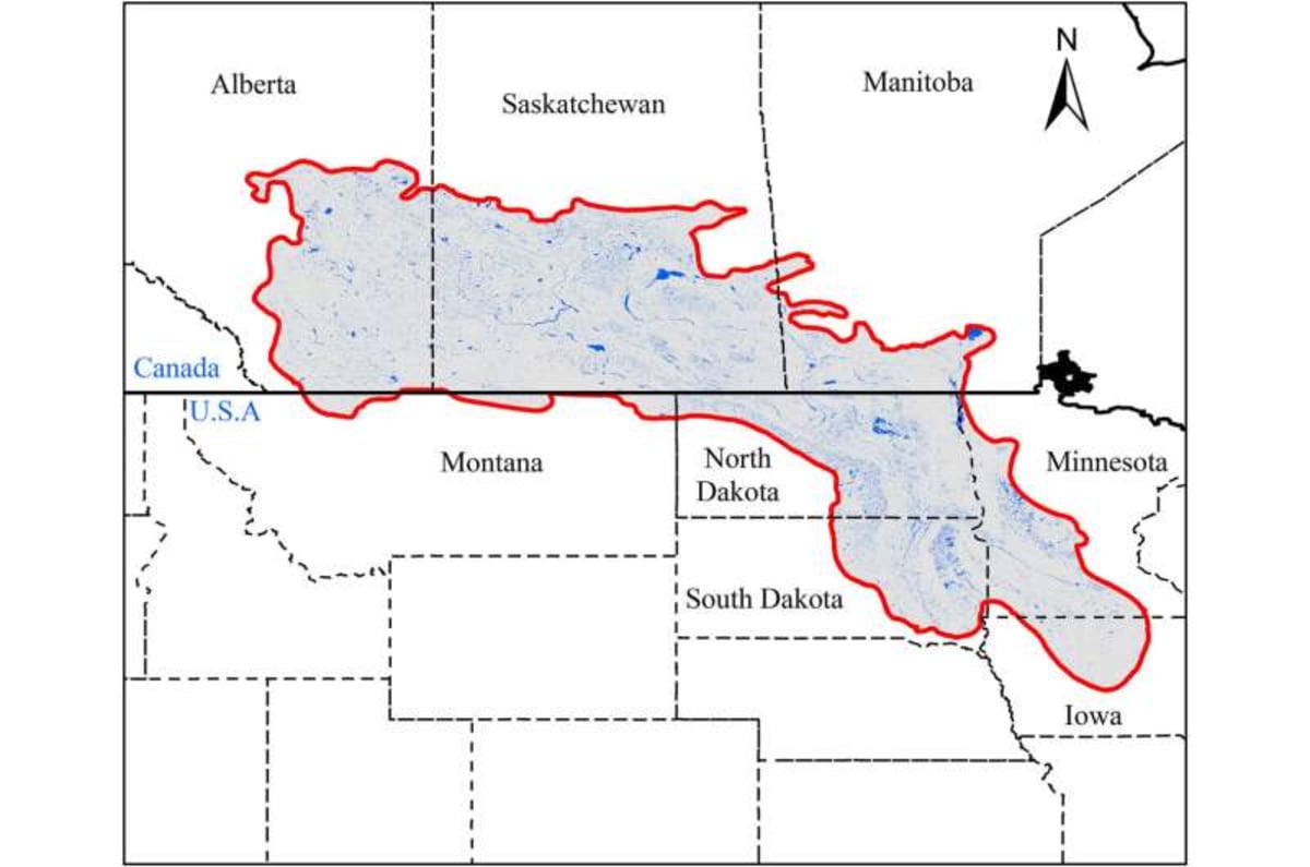
This vast landscape spanning five U.S. states and three Canadian provinces looks ordinary on maps. But beneath that calm surface lies thousands of small wetlands that behave like a giant, interconnected puzzle—one that stumped hydrologists for generations.
The problem? These wetlands fill up slowly, then suddenly spill over without warning. A watershed that looks bone-dry on Monday can unleash devastating floods by Tuesday, and traditional models couldn't predict when that switch would flip.
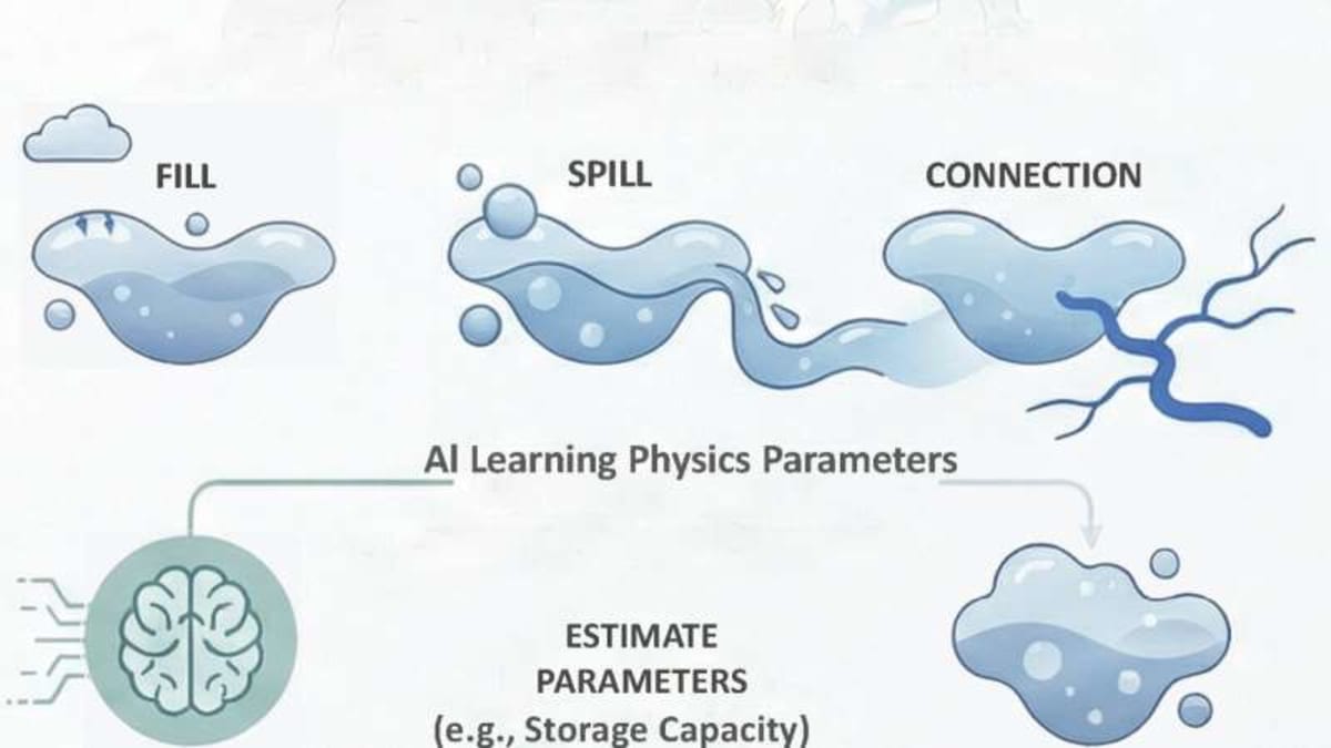
Researcher Ali Ameli and his team just published a solution in Water Resources Research that combines physics with artificial intelligence. Instead of treating the wetlands as inconvenient details, they made them the star of the show.
Their new model tracks how water moves between thousands of potholes, learning which ones matter most for flooding. The genius part? It works in places where scientists have never installed measuring equipment—which is most of the region.
This matters more than ever right now. Over half of the Prairie Pothole Region's natural wetlands have been drained for farming, removing nature's built-in flood sponges. Climate change is making rainstorms more intense, and communities have fewer tools to see disasters coming.
The region feeds much of North America, so protecting it protects food security for an entire continent. But most watersheds here have no stream gauges, meaning forecasters were essentially flying blind.
The Ripple Effect
The new model has already shown it can predict floods in watersheds it's never "seen" before. That means emergency managers across the northern Great Plains could finally get advance warning before floods hit, potentially saving lives and property.
Water quality experts are excited too. The model doesn't just predict when floods happen—it shows how nutrients move through connected wetlands, which could help farmers reduce runoff and protect downstream water supplies.
The framework works by respecting how water actually behaves in these landscapes—filling, spilling, and connecting—rather than forcing prairie wetlands to act like mountain streams. It's a reminder that sometimes the best solutions come from working with nature's quirks instead of against them.
Other researchers are already adapting the approach for similar landscapes worldwide, from the Canadian Shield to parts of Scandinavia and Russia. Anywhere that water pools in depressions before flowing downhill could benefit from this breakthrough.
For communities living with flood anxiety every spring, this model offers something precious: the ability to prepare instead of just react.
More Images

Based on reporting by Phys.org - Earth
This story was written by BrightWire based on verified news reports.
Spread the positivity!
Share this good news with someone who needs it