How Drones Map Floods to Guide Rescuers in Real Time
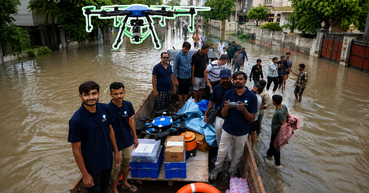
When floodwaters hide roads and trap families, drones give rescue teams a crucial advantage: seeing exactly where water is rising and who needs help most. In Gujarat's recent floods, this technology delivered food to stranded residents and showed teams which routes were still passable.
When floodwater swallows a village, rescuers face a deceptively simple problem: they know people need help, but they can't see where the water is or which roads still exist.
During Gujarat's recent floods, Prime UAV deployed drones over Dholka, Ahmedabad, turning chaos into clarity. The small flying machines surveyed areas too dangerous for boats or tractors, spotted stranded families even at night, and delivered food packets to locations cut off by rising water.
The real magic happens after the drone lands. Cameras capture hundreds of overlapping photographs during flight, which specialized software stitches together into a single detailed map called an orthomosaic.
These maps show rescue teams exactly what changed when the flood arrived. By comparing current aerial images with pre-flood surveys, responders can identify which roads disappeared underwater, which neighborhoods are isolated, and where people are waiting for help.
Some drones use laser measurements called LiDAR to map terrain elevation, revealing how water flows across the landscape. Others carry thermal cameras that detect body heat, helping locate people trapped in darkness or dense vegetation.
The technology doesn't wait for disaster to strike. Before monsoon season, teams fly drones over flood-prone areas to document rivers, embankments, bridges, and low-lying zones that fill first when water rises.
When floods hit, that "before picture" becomes invaluable. Fresh drone imagery overlaid on pre-flood maps instantly reveals what infrastructure survived, which escape routes remain open, and where rescue boats should go first.
Payload-carrying drones add another layer of immediate help. Waterproof boxes suspended beneath the aircraft can deliver food, water, and medical supplies to families surrounded by floodwater, buying time until boats or helicopters can reach them.
The Ripple Effect
The maps keep working long after rescue teams leave. Engineers use post-flood aerial surveys to assess damage to roads, bridges, and agricultural land, helping communities rebuild smarter.
Over time, these aerial records create a growing library of flood patterns. Authorities can study how water moves across terrain season after season, identifying areas that need stronger embankments or better drainage before the next monsoon arrives.
The drones aren't replacing rescue workers or boats. They're giving those teams something equally valuable: the ability to see the whole picture before stepping into danger, and the information to help more people faster.
When the next flood comes, those extra eyes in the sky could mean the difference between guessing where to go and knowing exactly who needs help first.
More Images
%2Fenglish-betterindia%2Fmedia%2Fmedia_files%2F2026%2F08%2F17%2Fdrone-rescue-2026-08-17-15-05-53.png)
%2Ffilters%3Aformat(webp)%2Fenglish-betterindia%2Fmedia%2Fmedia_files%2F2026%2F08%2F17%2Fdrone-rescue-2026-08-17-15-06-57.png)
%2Ffilters%3Aformat(webp)%2Fenglish-betterindia%2Fmedia%2Fmedia_files%2F2026%2F08%2F17%2Fdrone-rescue-2026-08-17-15-09-29.png)
Based on reporting by The Better India
This story was written by BrightWire based on verified news reports.
Spread the positivity!
Share this good news with someone who needs it