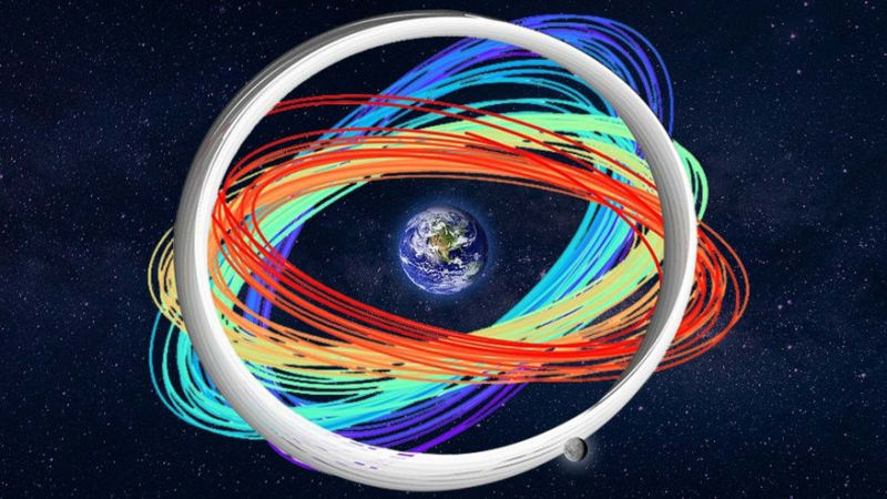
Scientists Map 1 Million Satellite Routes to Prevent Crashes
Researchers created a massive digital map of one million orbits around Earth and the moon to help prevent satellite collisions as space gets more crowded. The breakthrough could save billions in equipment and keep critical GPS and internet services running smoothly.


%2Fhttps%3A%2F%2Ftf-cmsv2-smithsonianmag-media.s3.amazonaws.com%2Ffiler_public%2F46%2F04%2F460434cf-e5b9-4471-af25-fa34f8031e69%2Fseven_sisters_mountains_gerlache_strait_antarctica.jpg)